
gcaptain | May 11, 2016
 Seaman Robert Hill takes celestial readings using a sextant on
the signal bridge of the aircraft carrier USS Abraham Lincoln
Seaman Robert Hill takes celestial readings using a sextant on
the signal bridge of the aircraft carrier USS Abraham Lincoln
In all, this is not a problem. I have sailed on many fully ECDIS compliant vessels, all of them for the same company. Almost all of the time everything goes well; install the cells that were requested, load the corrections, and continue with passage planning. However not all nations will provide their paper chart Temporary & Preliminary Notices to Mariners (T&P NM) corrections within their ENCs, therefore the responsibility of finding them lies with the mariner. I wrote about such issues in Slipping Through The Safety Net.
There are times when a single failure happens, and the systems need to be rebooted, generally while installing updates or other system maintenance. It is rare that a failure is long lasting, or that it would render the ECDIS system affected to be out of service for an extended period.
But, things do not always progress as planned. It is possible to experience a double failure, when both the primary and secondary ECDIS’s fail simultaneously. Equipment never fails on a beautiful day in the open ocean with near perfect visibility – everything fails in narrow channels, in inclement weather, or under pilotage. For that, Murphy’s Law is reliable.
If the ECDIS fails in the open ocean, it is not the worst case scenario – the vessel is clear of hazards and there is time to strategize, to make plotting sheets, and to verify your position. In open ocean there would normally be a chance to contact your company’s DPA and have them contact your chart provider to send PDF’s of the paper chart. These can then be taped together for use to sail for the nearest port for ECDIS repairs. And perhaps the delivery of paper charts to get through the voyage before repairs can be made. If the failure occurs in shallow waters and it is not safe to proceed then sometimes it is best to wait at anchor for charts to come. This all depends on your company’s emergency plan for ECDIS Failure.
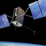
“In 1530, the cosmographer Reiner Gemma Frisius proposed a method based on the difference between the time at the port of departure, retained aboard ships by mechanical clocks, and the local time measured with astronomical instruments. Each hour of difference equaled fifteen degrees of longitude, and each degree of longitude was equivalent to a continuously varying distance from the Pole to the Equator.”
Once the problem of Longitude was solved – at least approximately, then the age of plotting hazards and the construction of useful navigational charts began. Sure some vessels made it to their destination, but many were lost in the effort to explore, to survey, plot and drop depth soundings, making up the base for later surveys and the charts we use now.
There were more backups for GPS and the satellite navigation systems, but they are not in use anymore. The use of systems such as LORAN-C and DECCA (along with cancelation of plans to upgrade transmitting stations to eLoran) were taught and tested on even after the U.S. Navy abandoned the instruction of Celestial Navigation, and as transmitting stations were being shut down. Now in the event of failure or blockage of GPS type systems, ships will be sent back to the 19th century sailing solely on DR and celestial positions and then putting that data into their 21st century ECDIS systems.
Some skills such as constructing plotting sheets on blank paper are only being mentioned in passing, but they should occasionally be done in practice. Maintaining skills that would be needed in an emergency to accomplish the task of navigating safely. The same applies to the ability to navigate by the use of a sextant, and to know the names of at least a few of the stars – they are skills that were frequently used fifty years ago but unfortunately, are falling out of frequent practice. Not only do these skills need to be maintained, but they should be actively practiced, and the necessary equipment for them such as the chronometer should be kept corrected and in a working condition.
While we are always moving forward with the use of automation and new technologies – we always must keep prior methods, skills, and contingencies in mind. Problems happen, things break down, equipment fails. Even now the prospect of computer viruses and threats of hackers could create problems with ECDIS and Integrated Bridge Systems. The sea is not a safe place, and while you cannot plan for all possible problems – many what if scenarios should be outlined ahead of time, and preparations made to deal with those problems should they occur.

Announcing Club gCaptain

eloran Archives – gCaptain

Sailing Legend Ditching Modern Tech in Daring Trans-Atlantic Race
South Korea Revives GPS Backup Project After Blaming North for Jamming

Slipping Through The Safety Net
Recommended For You
U.S. Navy Ordered to Shock Test World’s Costliest Ship

First U.S. Shale Gas Exports Imminent as Tanker Docks at Sabine Pass
Classic Video: Moran Tug Saves Pinned Tugboat from Getting Sucked Under Bridge

KKR Enters Maritime Finance

Executive Profile: Shell’s Sara Lawrence Brings a Blend of Experience to Marine Lubricants


